
Gwer East Local Government Area
Gwer-East was created in 1976 by the then regime of General Murtala Mohammed, home to the Masev people.
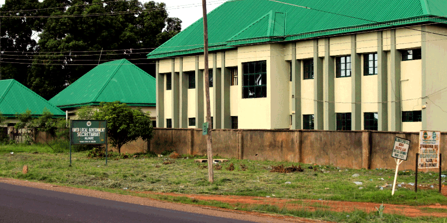
Headquarters:
Aliade
Landmass:
2,294 km2
Geographical location:
The land is located Southwest of Tar-Tiv, and occupies an area of about 8o and 9o east of the greenish meridian.
Population:
163,647 at the 2006 census
Districts:
- Yonov,
- Njiriv, and
- Ngyohov.
Council Wards:
Gwer has 14 council wards
Wards in Yonov axis
- Mbasombo
- Ikwe
- Mbalom
- Gbemacha
- Shough
Wards in Ngyohov axis
- Aliade/Mbalav
- Mbabur
- Ikyonov
- Gee
- Mbayom
- Akpachayi
Wards in Njiriv axis
- Ugee
- Ikyorgbajir
- Mbakyaan
Polling Units:
Gwer East has One Hundred and Fifty-Seven (157) polling units across Fourteen (14) districts in Fourteen (14) Council Wards.
Boundaries:
It shares boundaries with seven other local government areas:
- Ityoshin people of Gwer-West Local Government Area,
- Mbakor people of Tarka Local Government Area,
- Shangev-Tiev people of Konshisha Local Government Area
- Mbatyav people of Gboko Local Government Area,
- Igede people of Oju Local Government Area,
- Igede people Obi Local Government Area,
- Idoma people of Otukpo Local Government Area,
- Ugondo people of Makurdi Local Government Area.
The area stretches from a line to a few miles of Makurdi Local Government Area and Abinsi to within five and six miles of Otukpo Local Government Area. It is therefore, embraces the present boundaries of Gwer East Local Government Area and Makurdi Local Government Area of Benue State.
Tribes in Gwer local government area:
- Tiv, and
- Igede.
Religion:
And finally, there are a varied denominations of religions: Christians and Muslims inclusive all co-existing side by side.
Rivers:
The area is gently undulating and covered with fairly thick orchard bush, small rivers and streams such as:
- Gwer,
- Gbaya,
- Uhugh,
- Fete,
- Mu,
- Ujilagbo and many others.
which are all tributaries of River Benue.
Major Markets in Gwer East Local Government:
- Aliade market,
- Ikpayongo market,
- Igbor market,
- Taraku market,
- Ivur market,
- Fiidi market.
Economic Organizations:
Agriculture:
Farming which is the dominant occupation is practiced by the majority. The plains, unlike the hills, offer large opportunities for extensive farming which has become imperative because of the rapid growth in population.
Crops produce:
- Yam,
- Corn,
- Soya beans,
- Millet,
- Tobacco,
- Beniseed
Which are used as cash and consumable items.
Livestock farming:
There is also Livestock farming which also features prominently in Gwer-East economic organization. Importance is attached to the possession and rearing of livestock such as Goats, Sheep, Cattle, Chicken because it is a sure method of obtaining wealth.
Trading:
Trading is another feature in Gwer. As a result, markets have been established in different parts of the local government.
Craft making and smiting:
Craft making and smiting are part of Industrial life. Blacksmiths are known for their handiwork of designing hoes, axes, arrowheads, and cutlasses, used for failing of trees, cultivation as well as tilling the ground. Arrowheads are used in hunting and during the war.
Industrial life is further boosted by the famous Taraku Mills Limited, big oil and flow producing company, now leased to foreign managers.
The exchanges of these items between the Gwer people and their neighbors – the Igedes, Idomas, the Udam people, as well as their Tiv neighbors in Ihyarev in Gwer West Local Government Area, Ugambe in Konshisha Local Government Area all contribute to sustaining the economic growth of Gwer-East.
Transportation:
Gwer is served with motorable roads that link the area to all major settlements within and outside Benue Valley, for example, Konshisha Local Government Area, Gboko Local Government Area, Taraba, Otukpo Local Government Area, Enugu, Makurdi Local Government Area, Federal Capital Abuja and so on.
The Nigerian Eastern railway also passes through the area with stations at Taraku, Moi-Igbo, Kinga, and Agana.
Mineral resources/deposit:
There are a variety of mineral deposits in the area; some of these include:
- Salt at Mbayom,
- Hard-core stones, and
- Laterite at Mbasombo.
Clay is also found in virtually all three districts.